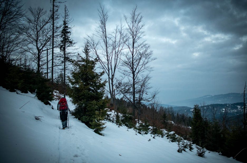

Why to winter hike in the Żywiec Beskids
✓ Walking with snowshoes and crossing trails that would otherwise be more difficult to walk on.
✓ A cross-border experience in Slovakia and Poland.
✓ Winter hut to hut in Poland’s second highest mountain range.
✓ Accommodation in mountain huts, including bedding, so you don’t need to carry a sleeping bag liner!
✓ Easy access to and from the start of the trail.
✓ Food is available in all huts, including breakfast, dinner, and snacks for the road, so you don’t need to carry food for several days.
Itinerary of winter hut to hut hike in the Żywiec Beskids

65
KM
4
Nights
5
Days
Day 1: Walking from Zwardoń to Wielka Racza
In the morning, a driver will pick you up and take you from Żywiec to the start of the route in the border town of Zwardoń. From Zwardoń, you will begin your hike in the Żywiec Beskids Mountains. As you climb the mountain, you will be introduced to the wooded landscapes of the ridge stretching between Slovakia and Poland. Towards the end of the day, you will reach the Wielka Racza viewpoint, from where you will continue on a short walk to the hut where you will spend your first night.
—
Estimated hiking profile
Difficulty: Moderate
Distance: 15 km
Highest point: 1,227 m.a.s.l.
Lowest point: 681 m.a.s.l.
Cumulative ascent: 847 m
Cumulative descent: 301 m
Transportation: Transfer from the town of Żywiec to the start of the trail in Zwardoń
Accommodation: Mountain hut in the Żywiec Beskids
Day 2: Walking from Wielka Racza to Rycerzowa
On the second day of hiking, you will mainly walk along the ridge’s watershed. Throughout the day, you will pass between different peaks until you reach the summit of Rycerzowa, from where you will continue to the second hut where you will spend the night.
—
Estimated hiking profile
Difficulty level: Moderate
Distance: 16 km
Highest point: 1,227 m.a.s.l.
Lowest point: 659 m.a.s.l.
Cumulative ascent: 552 m
Cumulative descent: 659 m
Accommodation: Mountain hut in the Skid Žiževský ridge
Day 3: Walking from Rycerzowa to Krawców
On this day, you will descend the mountain via one of the tributaries of the Cicha River until you reach the village of Soblówka. From Soblówka, you will continue walking along a rural road until you reach an ascent, from which you will continue back towards the border with Slovakia and the high point of Krawców. You will spend the night in a mountain hut in the Krawców area.
—
Estimated walking profile
Difficulty: Moderate
Distance: 14 km
Highest point: 1,122 m.a.s.l.
Lowest point: 607 m.a.s.l.
Cumulative ascent: 535 m
Cumulative descent: 614 m
Accommodation: Mountain hut in the Skid Žiževský ridge
Day 4: Walking from Krawców to Kopiec
The fourth day is particularly adventurous, climbing to an altitude of 1,356 Meters Above Sea Level. The trail passes between high points and the views are endless. At some point during the walk, you will meet a section of the main Beskid trail, which will take you to the mountain hut where you will sleep.
—
Estimated walking profile
Difficulty level: Moderate
Distance: 13 km
Highest point: 1,356 m.a.s.l.
Lowest point: 916 m.a.s.l.
Cumulative ascent: 627 m
Total descent: 384 m
Accommodation: Mountain hut in the Skid Žiževský ridge
Day 5: Walking from Kopiec to Hilny
You will begin the last day of the trip with an ascent to the summit of Pilsko, the highest point during this hike. After completing the ascent, you will begin the descent to Hilny, where there used to be a passport control station between Poland and Slovakia. When you arrive in Hilny, the driver will be waiting to take you to the town of Żywiec.
—
Estimated walking profile
Difficulty level: Moderate
Distance: 7 km
Highest point: 1,556 m.a.s.l.
Lowest point: 807m.a.s.l.
Transportation: Transfer from the end of the route to the city of Żywiec